


Burlington Precinct 3, Middlesex County, Massachusetts
About
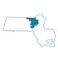
Outline

Summary
| Unique Area Identifier | 594546 |
| Name | Burlington Precinct 3 |
| County | Middlesex County |
| State | Massachusetts |
| Area (square miles) | 5.06 |
| Land Area (square miles) | 5.03 |
| Water Area (square miles) | 0.03 |
| % of Land Area | 99.47 |
| % of Water Area | 0.53 |
| Latitude of the Internal Point | 42.48768740 |
| Longtitude of the Internal Point | -71.20933570 |
Maps


Graphs
Select a template below for downloading or customizing gragh for Burlington Precinct 3, Middlesex County, Massachusetts


Neighbors
Neighoring Voting District (by Name) Neighboring Voting District on the Map
- Bedford Precinct 3, Middlesex County, MA
- Burlington Precinct 1, Middlesex County, MA
- Burlington Precinct 2, Middlesex County, MA
- Burlington Precinct 4, Middlesex County, MA
- Burlington Precinct 5, Middlesex County, MA
- Lexington Precinct 6, Middlesex County, MA
- Lexington Precinct 7, Middlesex County, MA
- Woburn Ward 3 Precinct 2, Middlesex County, MA
- Woburn Ward 7 Precinct 1, Middlesex County, MA
Top 10 Neighboring County Subdivision (by Population) Neighboring County Subdivision on the Map
- Woburn city, Middlesex County, MA (38,120)
- Lexington town, Middlesex County, MA (31,394)
- Burlington town, Middlesex County, MA (24,498)
- Bedford town, Middlesex County, MA (13,320)
Top 10 Neighboring Place (by Population) Neighboring Place on the Map
Top 10 Neighboring Unified School District (by Population) Neighboring Unified School District on the Map
- Woburn School District, MA (38,120)
- Lexington School District, MA (31,394)
- Burlington School District, MA (24,498)
- Bedford School District, MA (13,320)
Top 10 Neighboring State Legislative District Lower Chamber (by Population) Neighboring State Legislative District Lower Chamber on the Map
- Twenty-First Middlesex District, MA (41,914)
- Thirtieth Middlesex District, MA (39,361)
- Fifteenth Middlesex District, MA (39,001)
Top 10 Neighboring State Legislative District Upper Chamber (by Population) Neighboring State Legislative District Upper Chamber on the Map
Top 10 Neighboring 111th Congressional District (by Population) Neighboring 111th Congressional District on the Map
Top 10 Neighboring Census Tract (by Population) Neighboring Census Tract on the Map
- Census Tract 3322, Middlesex County, MA (8,376)
- Census Tract 3331, Middlesex County, MA (7,399)
- Census Tract 3323, Middlesex County, MA (6,677)
- Census Tract 3591, Middlesex County, MA (6,198)
- Census Tract 3332, Middlesex County, MA (5,364)
- Census Tract 3587, Middlesex County, MA (5,060)
- Census Tract 3585, Middlesex County, MA (4,861)
- Census Tract 3324, Middlesex County, MA (3,473)